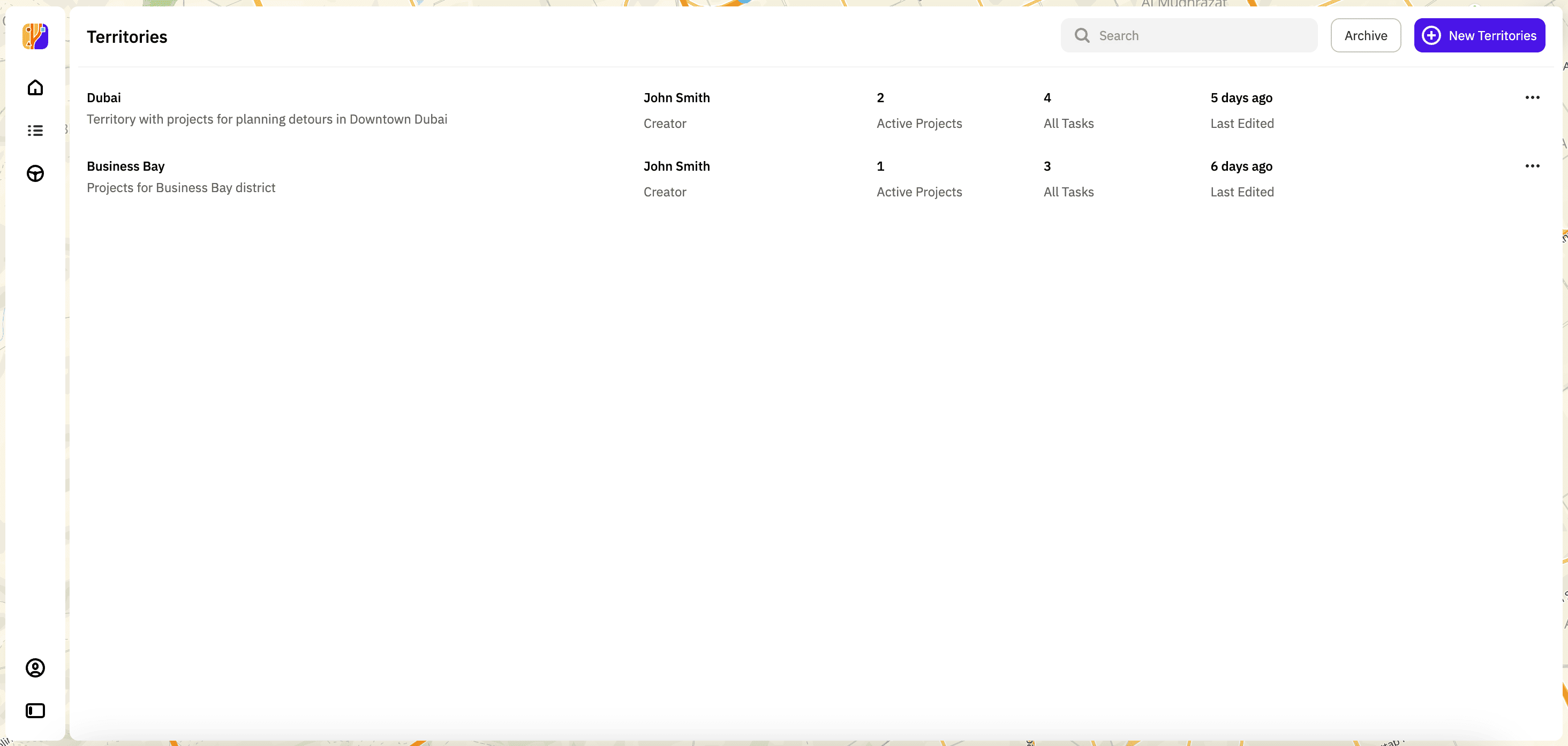
Territories
Territory is a set of projects corresponding to a particular territory on the map, such as a region, a city, a road, etc.
In the Task Planner, you can work with territories on the Tasks tab:
- create territories
- view information about territories
- edit territories
- archive territories and restore them from the archive
Creating a territory
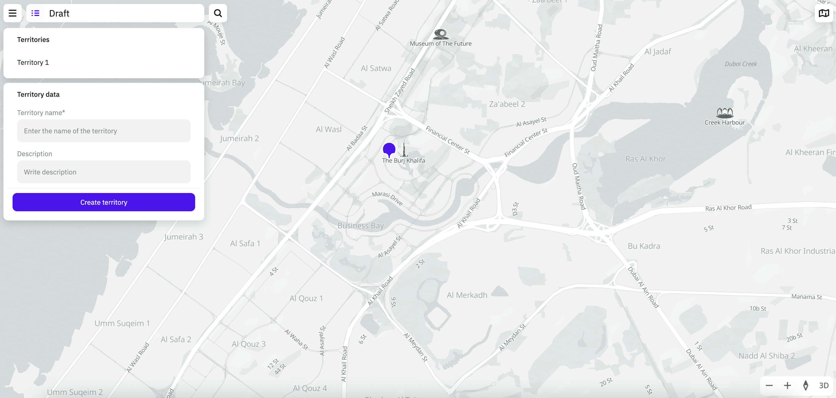
- Go to the Tasks tab.
- Click New Territories.
- Place a marker on the map at the approximate center of the territory. When creating a territory, you can use the search by addresses, places, and organizations on the map.
- Enter the territory name (mandatory parameter) and description.
- Click Create territory.
Viewing information about a territory
Go to the Tasks tab. The following information about all territories is displayed:
- territory name
- territory description
- territory creator
- number of active projects for the territory
- total number of tasks in all projects belonging to this territory
- date of last editing of projects belonging to this territory
Editing a territory
You can edit a territory:
- edit the map center
- rename the territory
- edit the territory description
To edit a territory:
- Go to the Tasks tab.
- In the territories list, click
 icon for the required territory and select Edit.
 - Apply necessary changes.
- Click Save territory.
Archiving a territory
You can only archive a territory if there are no current (active) projects in it.
- Go to the Tasks tab.
- In the territories list, click icon for the required territory and select Archive.
Restoring a territory from the archive
- Go to the Tasks tab.
- Click Archive.
- In the list of the archived territories, click icon for the required territory and select Restore.