2GIS API Platform MCP Server
Over the past few years, we have seen a tectonic shift in application development. Modern AI models have learned to write code, generate images, and maintain meaningful conversations. But as soon as they have to deal with the physical world - the one with traffic jams, addresses, and the laws of geometry - even the most capable neural networks suddenly become powerless.
The problem is fundamental. To a neural network, the world is a flat list of entities with no connections between them in a geospatial context. Language models have an excellent command of human language syntax, but their understanding of physical space is limited. For example, they cannot account for the fact that a left turn during the morning rush hour can take three minutes while a right turn takes twenty seconds; they cannot determine that a four-meter-high bridge is impassable for a truck.
Bringing geospatial context to AI
2GIS API Platform services know a great deal about the physical world and can fill these gaps. To make it easier to integrate AI systems with API resources, we are introducing a new tool: the 2GIS geospatial MCP server. MCP (Model Context Protocol) is an open standard that allows AI models to connect to external tools. Your AI agents can now call geospatial functions as easily as if they were built-in capabilities.
The 2GIS API Platform MCP server gives AI agents and large language models structured access to 2GIS API Platform services, equipping them with spatial awareness and geospatial capabilities to provide accurate, context-aware answers wherever geography matters. For more information about the services available in the current version of the MCP server, see the documentation.
You no longer need to manually chain together a dozen different API endpoints: search for an address with the Geocoder API, calculate a route with the Routing API, and filter points of interest with the Places API. Your agent can simply tell the server: "I need the fastest route from A to B, taking traffic into account and stopping at a veterinary clinic that is open right now." As the MCP server expands, a single user scenario can include multiple geospatial operations, such as searching for places and working with a map. The AI application determines the order in which the available tools are called. An agent or LLM equipped with the geospatial MCP server can call geospatial tools and access geospatial data to answer questions in a way that reflects the user's intent and the conditions of the surrounding physical world.
Simulating spatial reasoning inside a prompt is a dead end. To truly understand the physical world, AI needs a direct connection to that world. Our MCP server provides that connection.
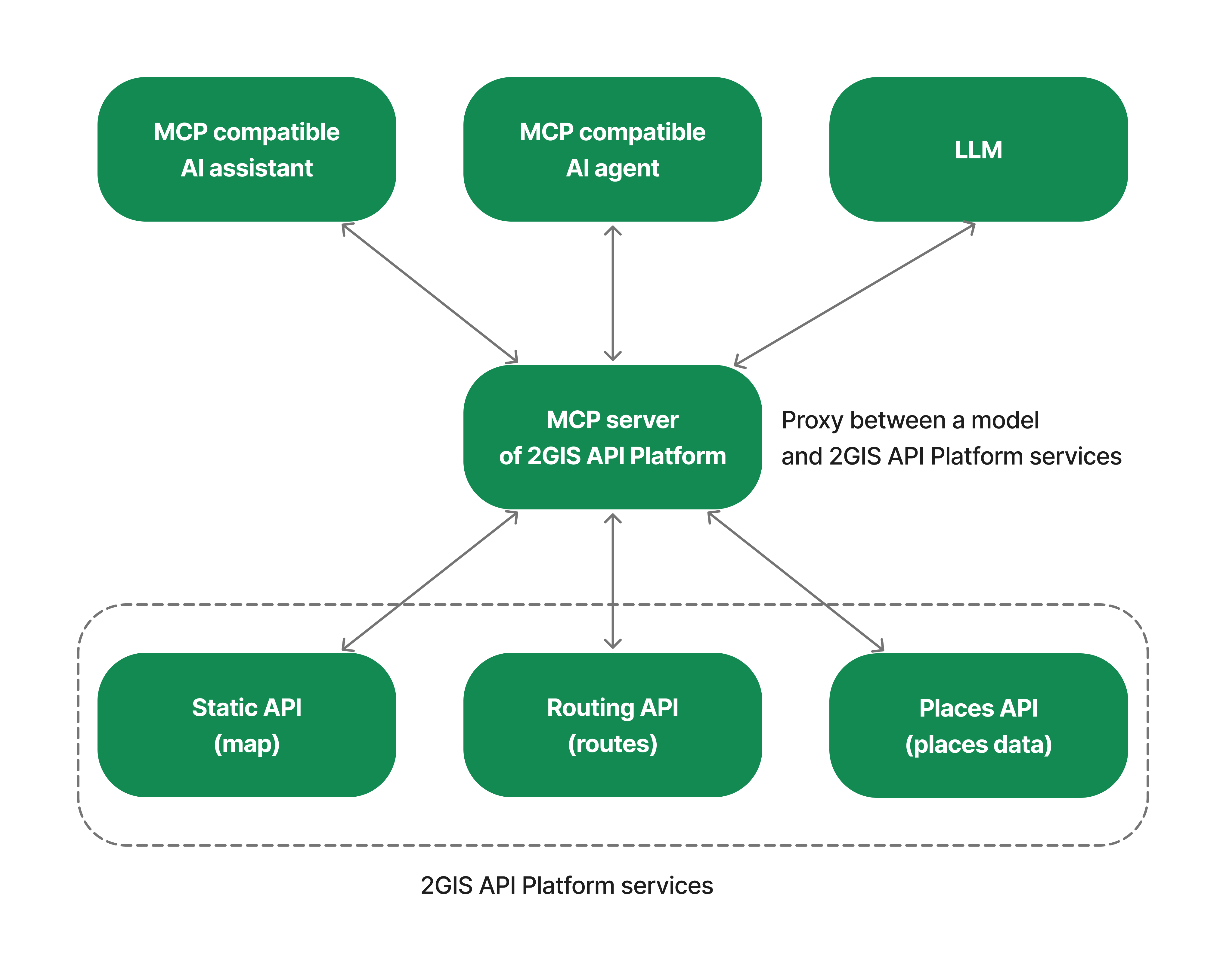
The 2GIS API Platform MCP server gives any AI agent or application geospatial knowledge by providing access to API Platform services.
How it works
An MCP server is an interface designed for AI systems such as assistants, agents, desktop AI applications, and other similar systems. It simplifies the interaction between AI applications and API Platform services. The AI agent decides when and how to call API Platform services to complete a task.
Use cases for your applications
A user asks: "I am moving to Sochi. Which neighborhoods should I consider renting an apartment in if I want to live near parks and within walking distance of a street with restaurants, while keeping my daily commute to the Sirius center by public transport under 60 minutes?". To answer this question, the agent can take the following approach:
- Determine the locations of Sochi and Sirius and find relevant addresses using geocoding (Geocoder API).
- Find clusters of restaurants and parks using directory search (Places API).
- Build routes to determine distances between locations (Routing API).
- Highlight the recommended areas on a map (Static API).
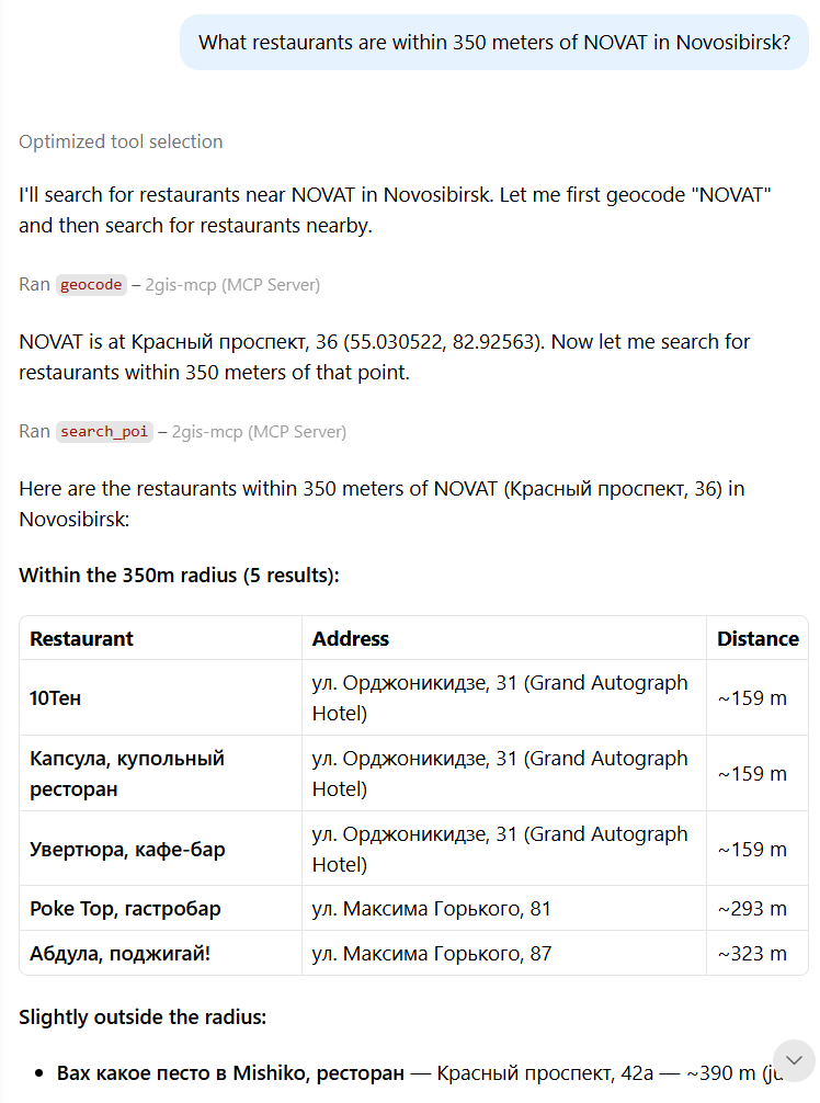
Developers building AI-powered services can use dozens of use cases that require interaction with the physical world, including real estate, travel guides, logistics systems, and recommendation systems. They can integrate the API Platform MCP server by hosting it in their own infrastructure and connecting their applications to API services with an API key. In addition to server applications, they can enable access to the MCP server in popular desktop clients such as Claude Desktop.
How to integrate
- Create an account in the Platform Manager.
- Create a demo API key or purchase a subscription.
- Connect your application to the 2GIS cloud MCP server or install the local MCP server distribution.
- Start using the available tools from your AI application.
See the documentation for detailed integration instructions.
Not all APIs are currently available through the MCP server. Development of the 2GIS API Platform MCP server is ongoing. The tool is continually adapted to market requirements, customer feedback, and new use cases.
Contact us to discuss how to build solutions at the intersection of AI and geospatial services and get expert advice.